

Článek
PointCab Origins 4.3 Pushes Point-Cloud Processing Further Into Everyday CAD Workflows
Point-cloud software is becoming an increasingly important link between reality capture and the design systems used by architects, engineers, surveyors and construction teams. PointCab Origins has long occupied that middle ground, turning laser-scanned environments into measurements, plans, sections and CAD-ready information. Its latest release, Origins 4.3, adds a substantial set of visualization, automation and modeling tools while continuing the product’s focus on making dense 3D survey data easier to use.
The September 2026 release introduces a new 3D viewer, contour-line generation, automated layout creation by floor, improved vectorization and several new mesh and volume capabilities. It also adds a new plugin connection for Vectorworks. These changes point to a broader direction for PointCab Origins: less emphasis on simply viewing point clouds and more on converting them into practical project information. Pointcab
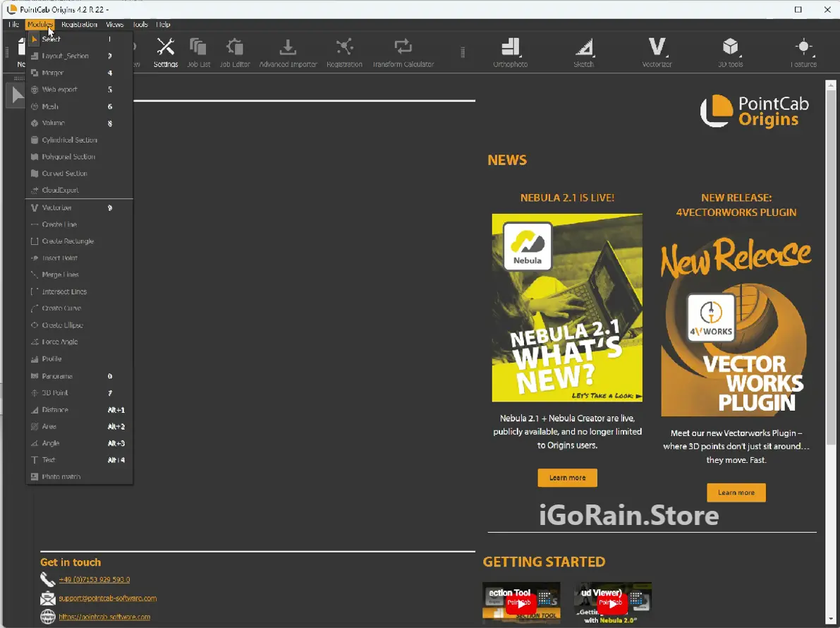
PointCab Origins
What Is PointCab Origins?
PointCab Origins 4.2 is desktop point-cloud processing software designed to evaluate data captured by terrestrial laser scanners, mobile and SLAM systems, drones and other compatible reality-capture equipment. Rather than requiring users to work directly with enormous raw point-cloud datasets throughout a project, Origins provides tools for extracting the information needed for downstream CAD and BIM work.
Its core workflow includes creating floor plans and sections, taking digital measurements, aligning projects, combining results, transforming coordinate systems and exporting information to CAD environments. The software also supports visualization through automatically generated orthographic views and panorama-oriented workflows. Pointcab 4.2
That positioning matters because point clouds can contain millions or billions of individual points. For many design and documentation tasks, users do not need every point in a CAD application. They need reliable geometry, dimensions, elevations, profiles and other selected information.
PointCab Origins download 2026 is built around that extraction process.
Origins 4.3 Adds More Automation and 3D Tools
The most significant current development is Origins 4.2 rel 22, released in September 2026.
Among the headline additions is a new 3D viewer, responding to customer requests and giving users another way to inspect point-cloud information. The update also introduces automated layout creation by floor, which could reduce repetitive work on multistory projects.
Other additions are more specialized but potentially valuable in production workflows. The release adds contour lines, a clipping filter, improved vectorizer controls, new CAD planar projection capabilities and the ability to export sketch elements to CAD. Users can also create lines and meshes in panorama views. Pointcab
The update extends analysis capabilities as well. PointCab has added a Stixel method for volume calculation, quad-mesh generation, mesh smoothing, profile-line smoothing and 3D point delta-distance display. Multiple E57 files can also be imported into separate clusters, which is relevant for projects assembled from different scanning sessions.
A new PointCab 4.2 Vectorworks plugin accompanies the release, connecting Origins with Vectorworks workflows. That expands the software’s CAD/BIM integration beyond its existing ecosystem of plugins and export workflows. Pointcab+1
From Laser Scan to CAD-Ready Deliverables
The central strength of PointCab Origins 2026 software is its emphasis on intermediate deliverables.
A surveyor can generate sections and floor plans from a point cloud rather than manually tracing an entire environment from scratch. Measurements can include distances, areas, angles and 3D points, while annotations and photographs can be associated with specific areas of the dataset.
For CAD users, Origins can export information in formats such as DWG and DXF. The software also includes a vectorizer for semi-automated creation of lines from point-cloud information, while its point-cloud export tools can isolate selected areas rather than forcing an entire scan into another application. Pointcab
That approach makes PointCab Origins particularly relevant to scan-to-CAD and scan-to-BIM workflows. PointCab also offers plugins designed to transfer selected 3D information into CAD applications, allowing users to work from prepared scan data without treating the full point cloud as the only source of geometry. Pointcab
Where the Software Fits
Architecture is an obvious use case. Existing-building surveys can provide a detailed foundation for renovation, documentation and BIM projects. Floor plans, sections and measurements can be produced from captured conditions before designers begin modeling.
Surveying and construction provide another strong application. Teams can compare conditions, calculate areas and volumes, create sections and prepare information for downstream design systems. The ability to combine data from different scanners is also important where projects involve terrestrial, mobile or UAV-based capture.
The same capabilities can support infrastructure documentation, industrial facilities, as-built surveys and other environments where accurate spatial information must move from reality capture into engineering or design software.
PointCab's own application material places particular emphasis on architects, engineers and construction professionals, while its broader platform connects Origins with cloud-based visualization and CAD/BIM plugins. Pointcab+1
Advantages and Limitations
The strongest argument for PointCab Origins is workflow efficiency. Its orthographic views, measurement tools, layouts, sections and export functions provide a relatively direct path from scan data to usable project documentation.
Another advantage is format and platform flexibility. PointCab says Origins is designed to work with point clouds from a broad range of scanning technologies and CAD systems, while Origins Core is currently offered for both Windows and macOS. Pointcab+1
The software is also positioned for users with different levels of experience. Tutorials and short introductory lessons are available, while more advanced functions cover registration, vectorization, meshes, volumes and specialized spatial transformations. Pointcab
There are limits, however. PointCab Origins does not eliminate the need for specialist judgment. Registration accuracy, scan quality, coordinate systems and the interpretation of complex geometry remain important. Automated vectorization and layout creation can reduce repetitive work, but they should not be treated as a substitute for professional review.
The broader CAD/BIM workflow can also determine how much value users get from the software. Teams already invested in particular modeling platforms may need to assess plugin compatibility, export requirements and how Origins fits alongside existing processing tools.
The Bigger Picture for Point-Cloud Software
PointCab Origins is developing at a time when reality capture is becoming more accessible and datasets are becoming richer. The challenge is increasingly not whether a building or site can be scanned, but how efficiently that information can become actionable design and construction data.
The latest release suggests PointCab origins 2026 is responding by expanding visualization while automating repetitive production tasks. Features such as floor-based layout creation, improved vectorization, contour generation and additional mesh workflows are practical responses to that challenge rather than a wholesale change in the product's purpose.
The longer-term direction will likely depend on how well point-cloud platforms connect capture, analysis, CAD, BIM and collaborative review. PointCab has already expanded that ecosystem through its Origins software, Nebula cloud product and CAD/BIM plugins. Its company history also shows continuing development of Origins alongside integrations with platforms including AutoCAD, Archicad and Revit. Pointcab+1
Conclusion
PointCab Origins remains focused on a practical problem: turning complex point-cloud data into information that professionals can actually use. The 4.3 release strengthens that proposition with a new 3D viewer, greater automation, expanded CAD interoperability and more sophisticated tools for meshes, volumes, profiles and visualization.
Its success will ultimately be measured less by the number of features added than by how much manual processing those features remove without compromising survey and modeling accuracy. For architecture, surveying, engineering and construction teams working with increasingly large reality-capture datasets, that remains a consequential challenge—and one that PointCab Origins is continuing to target directly.